Boundary Peak
The Plan: To reach the summit of Boundary Peak, a 13,140-feet summit in the White Mountains. It is the highest point in the state of Nevada.
Earlier in the week, I met my friend Ryan for a cup of coffee on campus. I was back at work after a week-and-a-half off to Oregon and California (more on this to come). We were catching up and further developing our plans for an upcoming visit to Great Basin National Park and an ascent of Wheeler Peak.
Wheeler is part of my training plan for an attempt at Mt. Whitney in August. But the historic snowfall in the Sierra this past winter has many trails snowed in still, now in the middle of July. So with a month or so until our permitted time for Whitney, I’m a little worried about being ready for the tallest point in the lower 48 as there just has not been a lot of opportunities to work on large elevation gains, especially at significant altitude. I asked Ryan about Boundary Peak, as he completed a winter ascent previously. Within a short amount of time, we had a plan in place: Drive from Reno on Friday and set up camp, either at the Queen Mine or higher if possible, and hike Boundary Peak on Saturday.
Before we go too far, understand these things about Boundary Peak and the hike:
- It’s hard. It was a five-mile hike from our campsite to the peak. Roughly two miles of that is flat. So we gained roughly 3,300 feet of elevation, up to 13,140, in only three miles. It was, very simply, the most grueling hike I’ve done to date.
- The first half of the trail is good, hard-packed trail but after that, it’s a steep climb, scrambling on scree to the peak.
- Because of the above, and other factors, it’s not a popular trail. On a Saturday in July, we saw one other human being. One of the main reasons it gets climbed is for highpointing.
- As recently as 20 or 30 years ago, many thought the peak was actually in California. And there’s debate, amongst those who care about such things, if Boundary is even it’s own peak, as the taller Montgomery peak looms nearby across a ridge. I don’t much care about that.
- There are two routes to the summit – Trail Canyon from the California side and the Queen Mine route from the Nevada side on the north. We took the latter and my hunch is that it might the better way to go, though I don’t have evidence to the contrary.
The shortest and quickest route to the trailhead was through Hawthorne, Nev., connecting on to U.S. Highway 6 south of Mina via state highway 360. We left Reno a little after 5 p.m. on Friday, driving in my wife’s Subaru Forester and made a quick stop in Fallon to top off the gas tank and grab a bite.
There’s no marked turnoff to the Queen Mine and the trailhead from Highway 6. There’s an old water tank with “JR” painted on it on the north side of the highway. Turn south on the dirt road across from that and you’ll be on your way. From the highway, it’s six miles to the Queen Mine and a total of 7.1 to the saddle where we camped. The first half of the drive is not terrible on the dirt road. But because of the terrain and the lack of road maintenance due to overall lack of traffic (I’m guessing) it gets a bit dicey on the second half. There are a handful of washed out areas and uneven sections, and we drove it in the dark.
Just my opinion, but any vehicle with decent clearance should be able to get to the Queen Mine. I wouldn’t try to go much further than that without four-wheel or all-wheel drive.
We arrived at the main saddle near the trailhead about 9:30 p.m. and set up camp. Was surprised to have a bar or two of cell service at the saddle and found that service continued as times throughout the hike all the way to the top, strong enough to do a Facebook Live stream as we reached it.
We set up camp quickly and walked around the saddle. The remoteness of the area led to a stunning array of stars throughout the sky. At one point, Ryan noticed a set of glowing eyeballs fixed on us in the distance, maybe 75 yards away. Then another set appeared. And then another. I tossed a rock in the area and all three sets of eyes scattered. As that happened, the light from our headlamps was enough to make out three mule deer, which was a bit of a relief
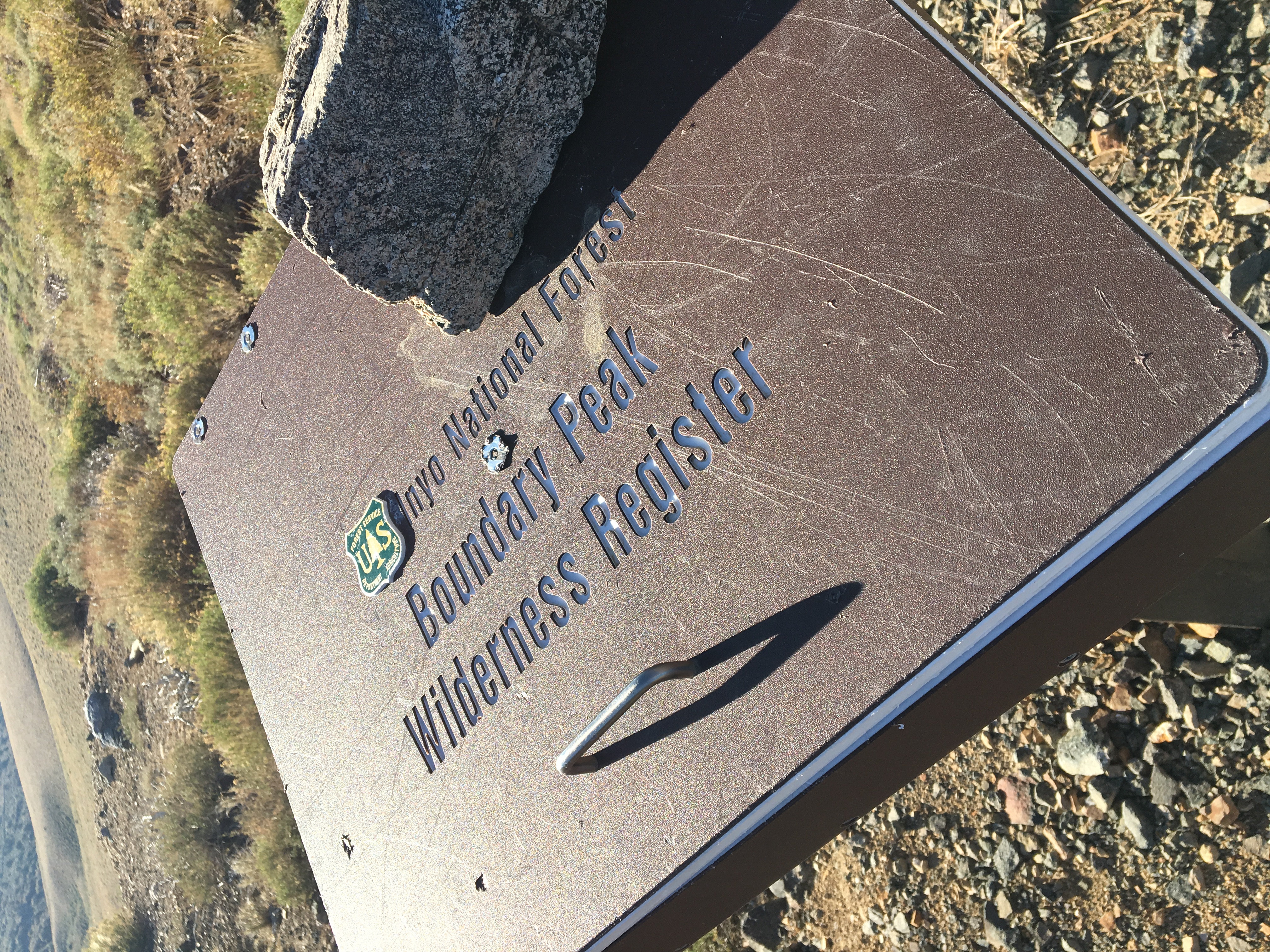
I woke up around six and caught a decent sunrise. We started to get ready for the hike, packed up the tent and got to the trailhead just after 7. At the trailhead box, there was a new register, placed there on July 1 from a couple that wrote about each completing their 50th and final highpoint that day, and then getting married, which seems like a pretty cool thing.
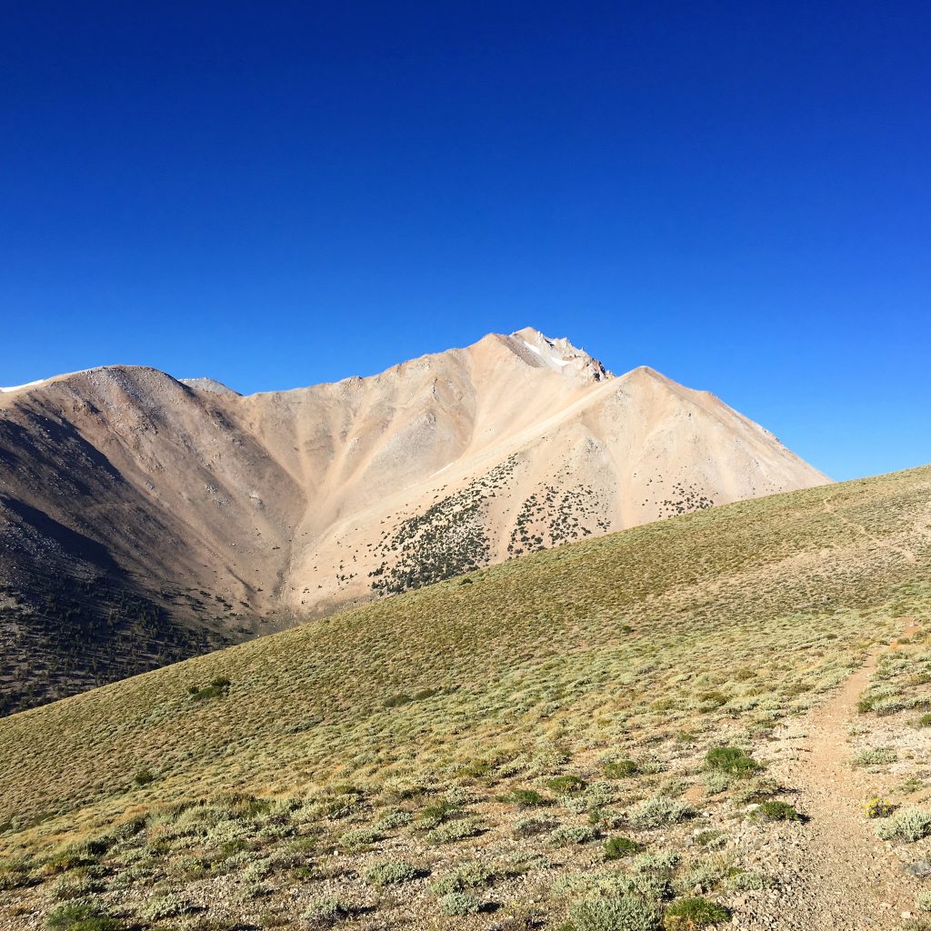
The first mile of the hike is a terrific precursor of what’s to come, with gains of about 1,000 feet of elevation. As you gain a ridge, and Boundary comes into view, the enormity of the task at hands is pretty striking.
From that ridge, it’s nearly two miles of flat trail, and some gentle downhill, to another saddle and a decent spot for a break before the mountain begins to kick your ass. At this point we were at about 10,800 feet, which left roughly 2,300 feet to climb in a little more than two miles.
Going into the hike, I was much more focused on bigger concepts, like how my body would handle hiking at significant altitude and gaining large chunks of elevation while at altitude. I don’t think I paid enough attention to the specifics of this hike. After all, the highest point I had ever hiked to prior to this was nearly two years ago when Ryan and I tackled the triple-crown of Freel Peak, Job’s Peak and Job’s Sister in a day.
Essentially, I was sitting at the highest elevation I had ever hiked to before (Freel is 10,881 feet), and still had more than two thousand feet to climb, in just over two miles. I wish I grabbed a picture from the spot looking up. That visual will be in my head for a while.
We began our slog up the hill, climbing and switch-backing before side-hilling it to catch a ridge. I found myself taking a number of pauses – 20- and 30-second breaks – just to keep my heart rate in check at first. Soon, it was more so because catching your breath would take an extra breath or so as you gained in elevation. We reached the second saddle and stopped shortly thereafter for a bite to eat.
Quick aside here: It was striking the fauna and flora at such a high altitude. We saw a number of squirrels and birds, and had bees and bugs buzzing throughout. Plenty of wildflowers to be found the hike as well.
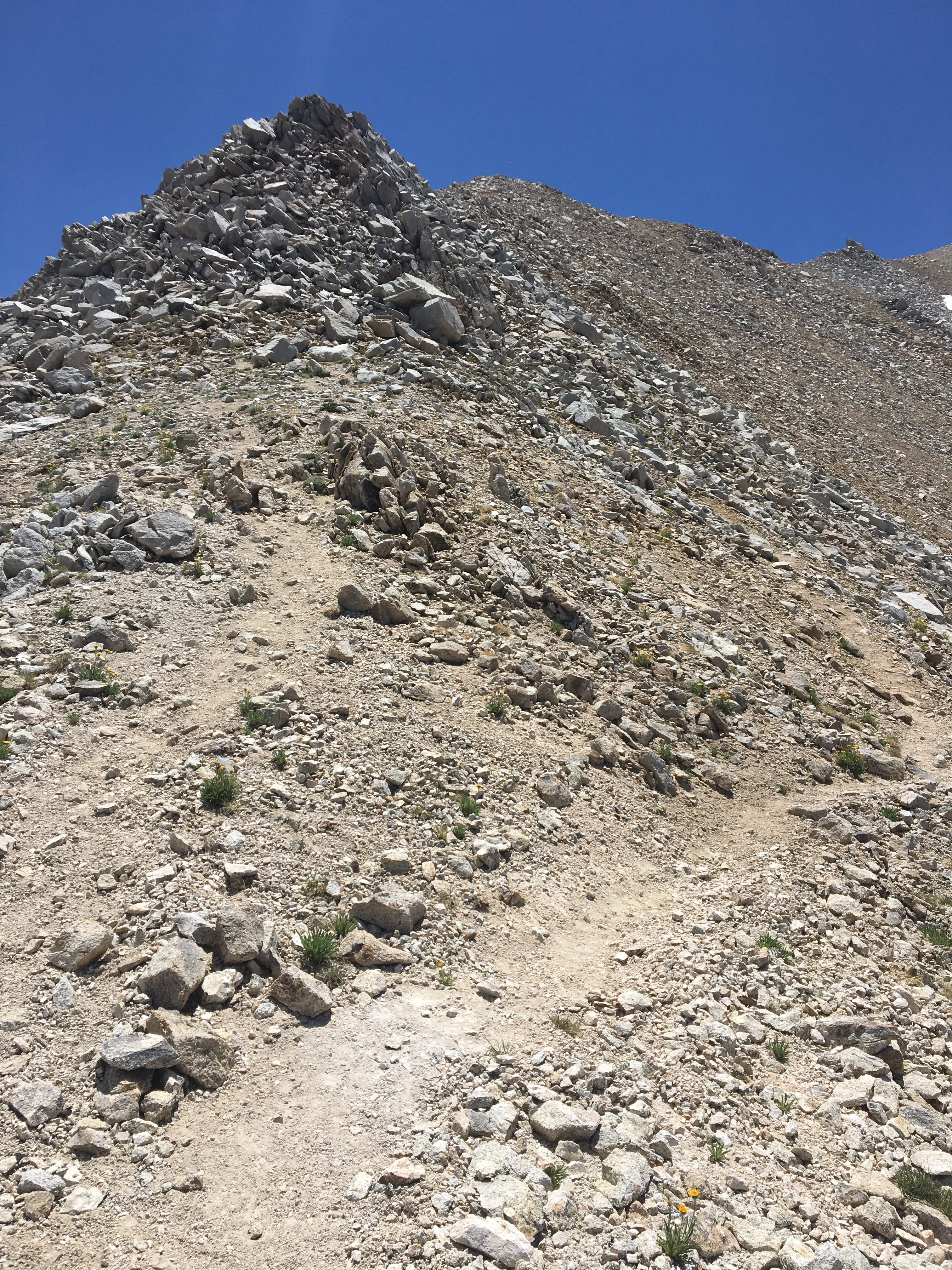
We were right around 12,000 feet, with a little more than a thousand to go, over the course of a mile. As you start up the ridge, the trail splits and the more well-worn of this use trail goes to the right side of the ridge, and that’s the way we went. However, if you are reading this as some sort of preparation for your own trip to Boundary, I suggest staying left, and on top of the ridge, as much as possible as the footing is simply more secure on that route. On the right side of the ridge, we were consistently slipping in the scree and trying to maintain some semblance of staying on the trail. Whichever way you go, pay attention to rock stacks, which have been placed throughout that section.
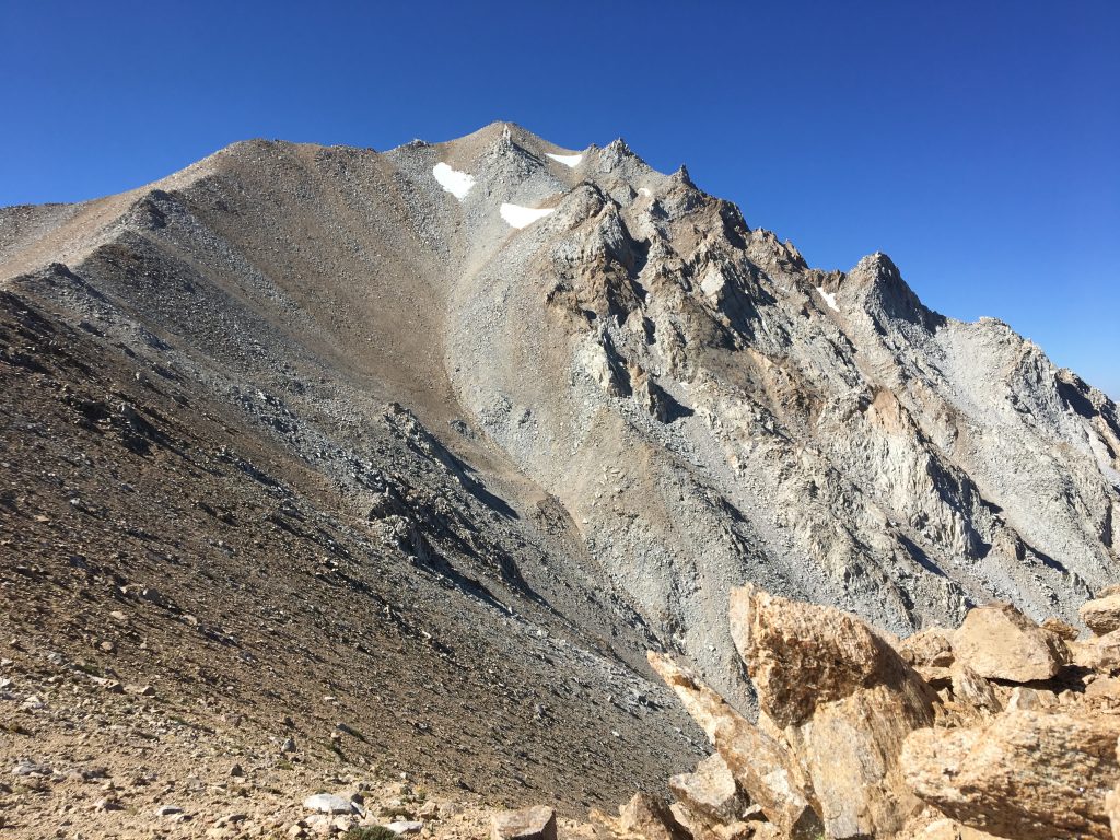
Once past the final set of boulders near the summit, you can reach the peak going around either the left or the right side. We went up the left side, as you look at it from the use trail, and came do the right side and the latter is the better way to go.
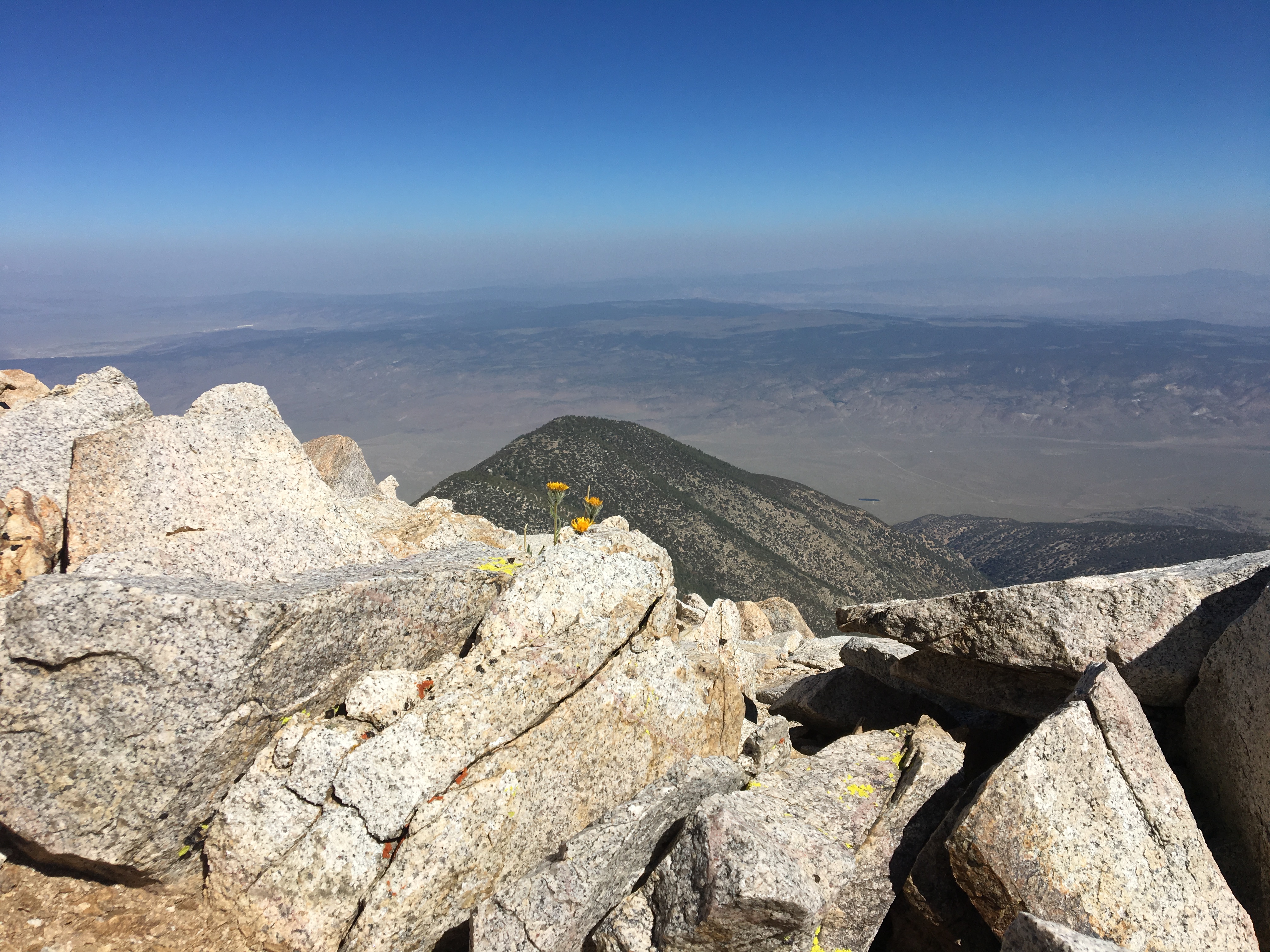
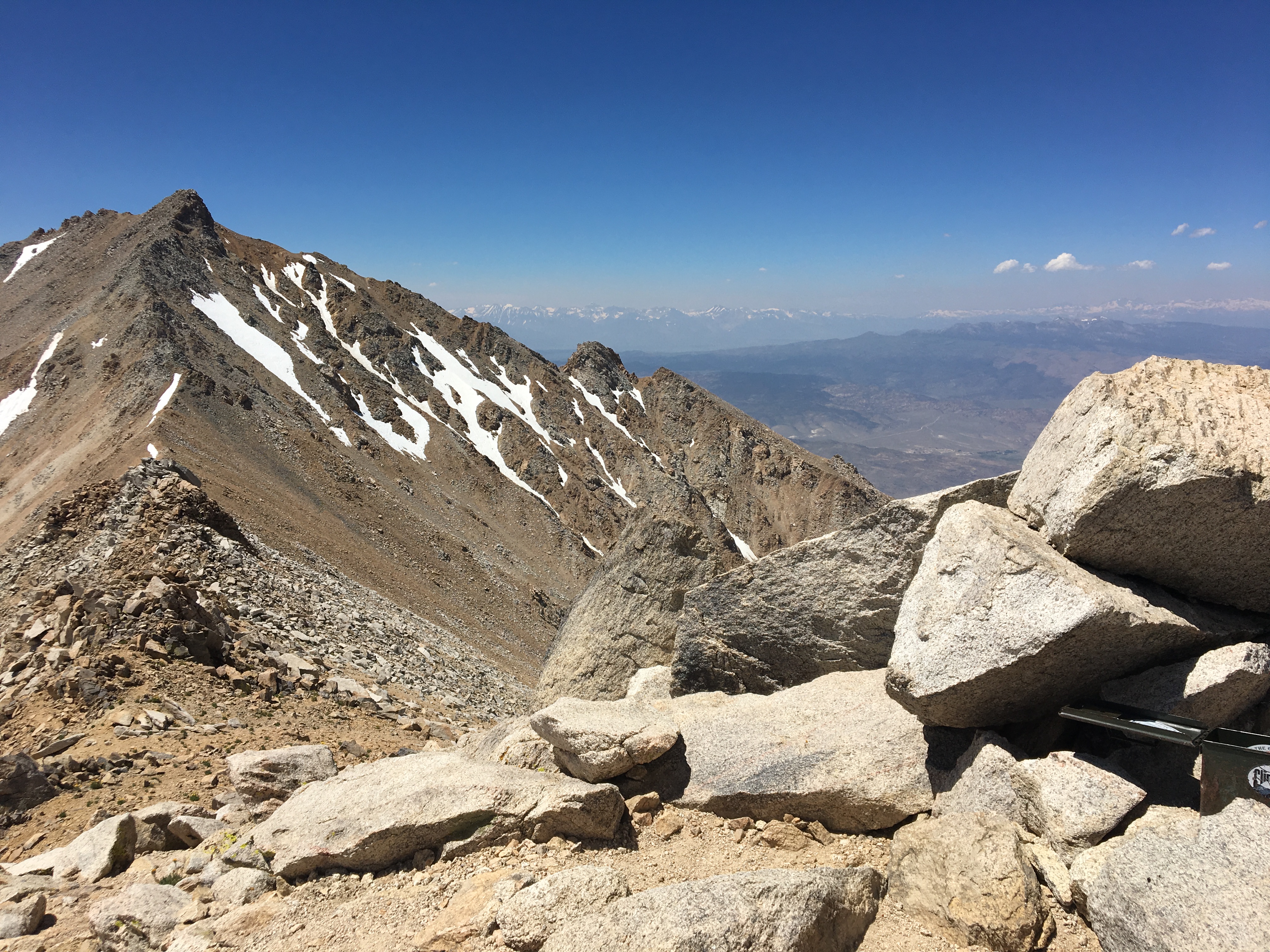
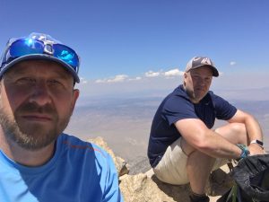
We reached the summit at 11:45 a.m. It was warm, and the wind that was there was welcome and refreshing. The views, despite some lingering haze from wildfires in the region, were stunning. The eastern side of the Sierra guarded the entire west side of the view point. In the foreground, a cool peak we later learned is Glass Mountain. To the south, White Mountain Peak loomed at the edge of the range. There was a neat lush valley socked in the middle of the range where wild horses roam. It was a pretty awesome place to be.
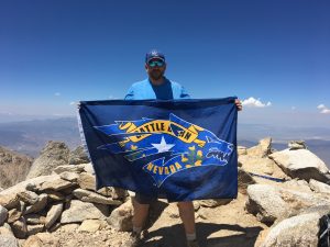
Normally, when reaching a summit, I have the expected sense of accomplishment … the feeling of climbing and achieving and reaching a goal. The feeling was a bit muted atop Boundary. On one hand, it was incredibly cool to stand atop the highest point in the state that I have called home for nearly three decades. While I had just climbed some 3,300 feet to get to this point, the feelings of satisfaction and accomplishment were delayed. It was not lost on me that the trip down – both on foot and in the car down the rough road from the camp site – was going to be demanding.
We stayed atop the ridge on the descent, save for one point where I ventured down to the lower trail to pick up a water bottle that had fallen out of my pack while scrambling up. While on the ridge, we stopped for a second to chat with a guy coming up, the only other person we saw on the mountain that day. The first thousand feet down wasn’t that bad because of being on the ridge, where the trail was a bit more secure. The next thousand feet or so were a loose mess and I stopped twice to remove rocks from my boots. It was an unbelievable relief to reach the midpoint saddle and them embark on the flat-ish part.
We reached the car just after 3 p.m., marking an eight-hour roundtrip, including the 30-45 minutes we spent at the peak. We started driving down the road to Queen Mine and it wasn’t nearly as bad as I feared. Doing the drive in daylight certainly helped.
We decided to head west on Highway 6 and loop home via 395. That meant a turn-off at Benton (I really want to check out the Benton Hot Springs some time) and a really neat drive on state route 120, which connects to 395 just south of Mono Lake and Lee Vining. After a stop for the only real meal of the day, we were back on the road and back to Reno by 8 p.m. on Saturday.
Looking back, I am pretty proud of this hike. It was, very simply, the most grueling hike that I have ever done. It kicked my ass at times, but I completed it and am better for it. I’m thankful for Ryan’s eagerness to do it, and pretty impressed that he did this previously during winter. His Strava report is pretty cool.
During my quick research on Boundary, I came across the very cool Calipidder blog. It’s very much worth some time. For me, as a frequent visitor to Bend, it was enjoyable to read some of her recent Oregon posts. I’m a fan.
Also of note, no Moose on this hike. Ryan suggested bringing him was not a good idea, mostly because Ryan doesn’t think dogs should be allowed in public places. I didn’t bring Moose because he had a bad stretch in June dealing with some sort of back injury or soft tissue injury, suffered either during or shortly after my last Church’s Pond hike in May. He seems back to normal now, but it didn’t feel like this would be the best trip for him. In retrospect, it was absolutely the right decision. The last two miles of the hike, climbing in scree, would have been tough on him.
Gear: I don’t have big, rugged, durable hiking boots as I’ve always preferred lighter footwear. That may change. I wore my Under Armour boots, and while I had no major issues, they didn’t provide the level of cushioning, especially near the toes, that would have been better for this hike. The downhill portions, especially the last mile on decent hard-packed trail, were somewhat painful.
I brought the hiking sticks, which were mostly helpful but at times a hindrance. Osprey day pack was perfect for this, and it easily held a jacket, pants, 2-liter bladder, 1-liter water bottle, pocket knife, portable charger, two bagels and multiple protein and granola bars.
Every time I hike with Ryan, I seem to pick up a good tip or trick. No exception here. Like many, I suppose, I have a tendency to pack lighter, healthier foods and snacks on hikes, and there’s nothing wrong with that on shorter day hikes. But this thing was a beast, and coming off a night camping I should have thought about food that provided more sustenance. During a lunch break, when I was devouring a bland protein bar and feeling like I needed more, Ryan was fueling with peanut butter sandwiches. Paraphrasing: “There’s other times for nutrition, this is a time for calories.”
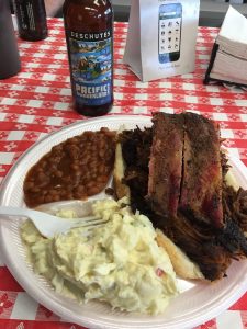
Post-hike beer: Ryan and I enjoyed a small growler of Amazon Gift Card, my most recent hoppy homebrew, after arriving at the saddle and setting up camp. After the hike, we stopped off at the Whoa Nellie Deli in Lee Vining. An Epic IPA from Mammoth Brewing never tasted so good.
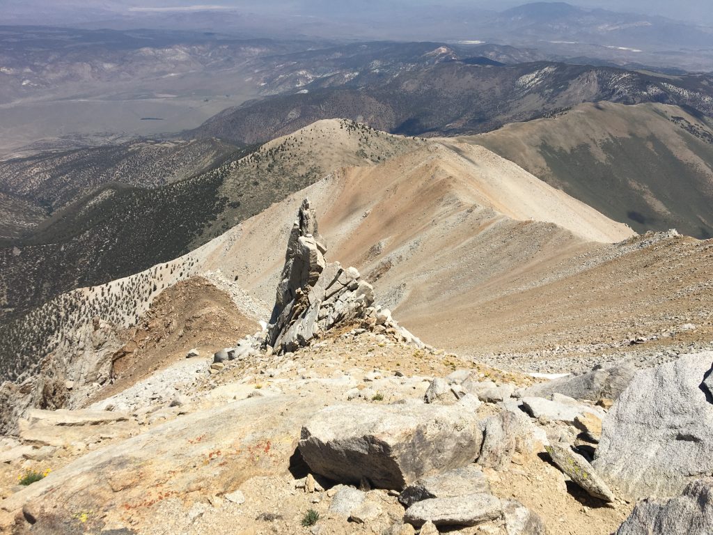
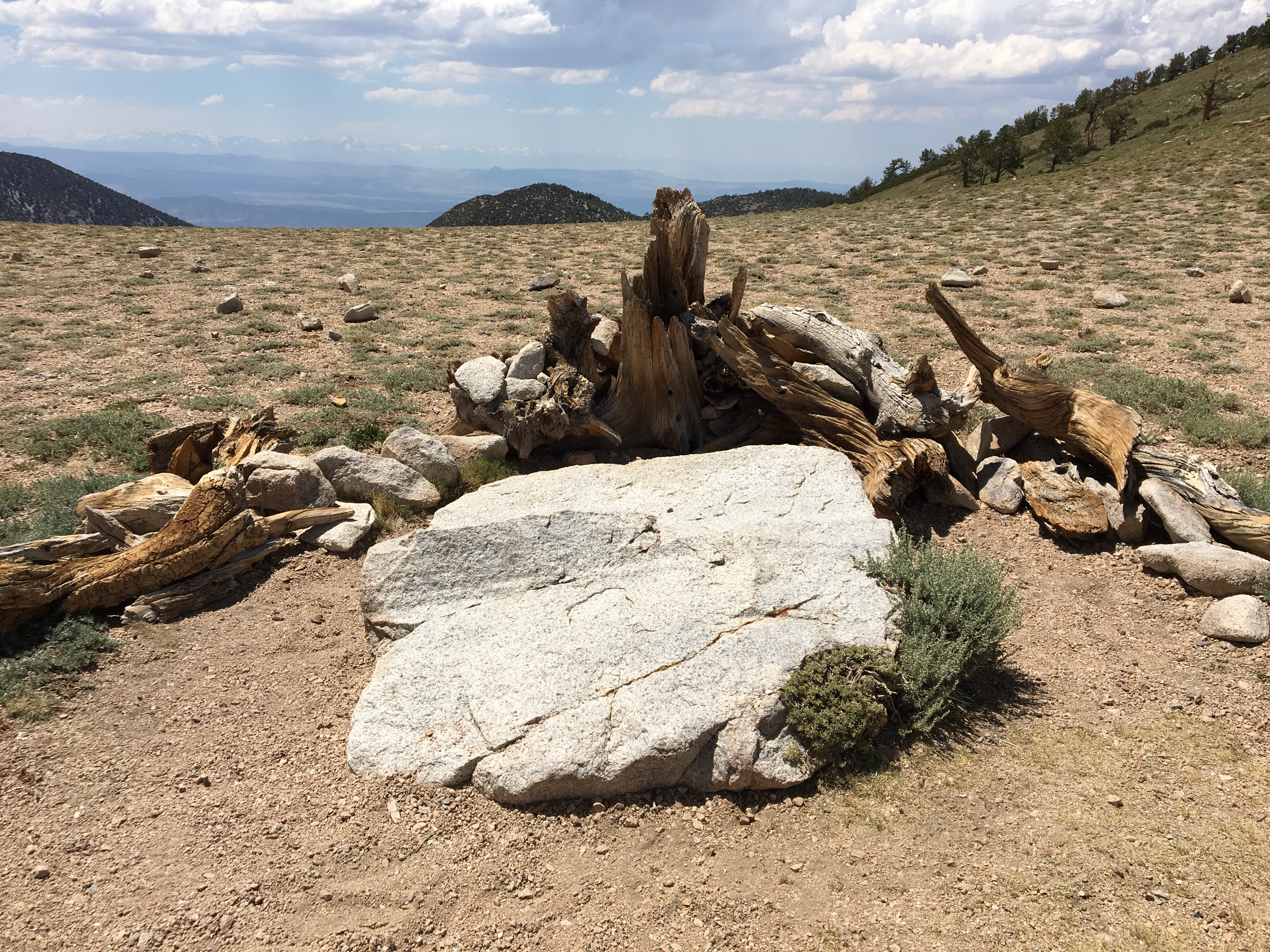
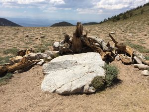
Finally, I love this shot from the peak, looking back down at the ridge coming up: